Rossomme Farm no longer exists as it was burnt down a century ago. Napoleon's use of the farm as his main headquarters location for most of the battle seems odd. The farm is quite far back from the scene of the fighting with Wellington's army and quite the wrong place to control the battle.
Why then did Napoleon select this location? A number of reasons may be presumed: first, Napoleon had handed tactical control of the battle to Ney and did not intend to micro-manage his deputy; secondly, Napoleon was famously troubled by stomach complaints and may have wanted to maintain some privacy; finally, the heights of Rossomme provided the only place where Napoleon could both view the Anglo-Dutch battle on the Mont St Jean ridge and mind the looming 'Prussian threat in Plancenoit.
In building a model of Rossomme there is really very little historical evidence to go on and the only image I have seen of the farm contradicts the more compelling evidence provided by the Siborne model.
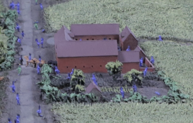
Siborne shows the farm as follow (images by kind permission of the National Army Museum):
Taking this evidence, we can see that Rossomme follows the same Walloon fortified farm pattern of La Haye Sainte, Papelotte, Mont St Jean and some of the farms at Quatre Bras. There is a dwelling and series of barns and walls around a main courtyard which is somewhat smaller than the other Waterloo farms but still significant. There is a garden to the south with a small outhouse. At the northwest corner of the farm is a pond and while the farm is fortified in appearance, there is a gap adjacent to the pond. The farm is on the east side of the main road. To the east, the land rises up to the heights of Rossomme.
Map evidence supports Sibonne's layout for the farm and indicates that the complex lay just north of a junction with a track splitting in a northwesterly direction towards Hougoumont.
Today on Google Earth, there is very little to see:
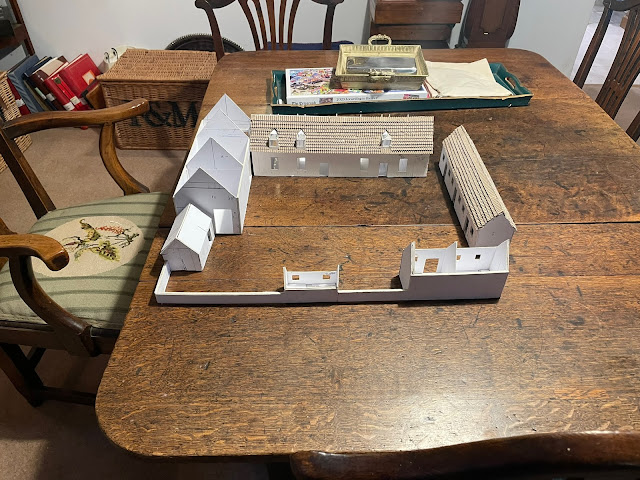
With all this evidence in mind, my father is kindly constructing the farm and here are some early photographs:


